
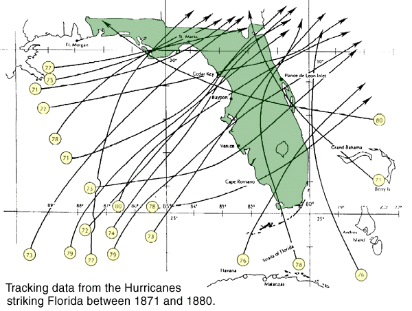
We think we have storms now...just look at the tracks from the 1870's! (Click image for larger view.)
Words like Camille, Andrew, Kate and Hugo conjure up terrible memories for a great many people. These are some of the more recent and costly Hurricanes. Prior to Andrew, Hugo (1989) was the most costly at something like 7 billion dollars in damages. Camille (1969) rode in at about one and a half billion! Also consider the difference in dollar value for the date when thinking of damages. As a mental exercise, work out a comparison between the true value of the damage in today's dollars of the 1947 Florida/La. hurricane (then a 100 million dollar loss) and the more recent Kate (1985) at a 300 million dollar loss. Andrew, of course, tops them all in dollar damage as it comes in at over 25 billion!
The word hurricane probably comes to us via the Spanish explorers from the Taino Indian (of the Caribbean, now extinct) word huracan (evil spirit). It is also highly probable that the word came to the Tainos from the Maya word Huraken (God of Storms or bad weather).
Although the Army Signal Corps, beginning in 1873, had been attempting to issue storm warnings, there was no official tracking of hurricanes in the U. S. until 1890. Following a bad storm in 1899 a more comprehensive system was established during the McKinley administration. The great 1900 storm occurred before the warning system was in place.
While living (briefly!) in California, this writer experienced two earthquakes. During the day following the worst of these, several neighbors collected in my yard (the only shade tree around!) to await the after shocks. One of the many discussions involved a comparison between living in earthquake prone areas and the hurricane prone territory I am native to. I certainly chose hurricane territory. There you have ample warning and time to "over" prepare or evacuate the area as you choose. I did not care for the thought of again being lifted, chair and all, about 3 feet up and hurtled some 20+ feet across the room along with cups, canned goods, table lamps, etc. with absolutely no hint of a warning.
|
The usual hurricane begins as a mere wave or "wrinkle" in the normal easterly flow of the tropical winds. This wrinkle requires much heat energy to continue. Given enough heat energy radiating from the warmed tropical waters, the rising heated air begins to circulate much as we have all seen in the little "dust devils" that form on a hot afternoon along a sandy beach. As this circulation is fed more heated air it grows to form a chimney like effect where there is low atmospheric pressure at its base and higher pressure at its top. This higher pressure area produces an anticyclonic circulation in which the rising air is spun outward away from the center or eye. Some of this cooled air drops back into the eye. As this air is then warmed by compression while it sinks, it can evaporate moisture causing the storm eye to become cloud-free and calm.
The most violent part of a hurricane is the eyewall. It is in this portion that the newly risen air loses its moisture giving more heat (latent heat of condensation) to the hurricane engine. This added heat causes the air to rise even faster along the eyewall. The temperature differential across the eyewall is great as the rising air is much warmer than the circulating air. This also creates a pressure differential across the eyewall. The hot rising air causes much less pressure than the "cooler" (only warm!) circulating air.
The difference in this pressure is a good indicator of the strength or growth potential of the hurricane. For this reason the practice of sending specially equipped aircraft into the eye of a storm is still utilized as satellites cannot yet "see" this important detail.
The pressure differential is also the reason those of us on the coastal regions have to pay careful attention to "storm surges" or storm produced high tides. The severely reduced pressure in the center of the storm can cause the sea level there to rise greatly . Hurricane Gilbert (1988) holds the present century's low pressure record with a reading of 26.22 inchesHg (normal is 29.94) and Camille came in at 26.73. Add this rise in water level to the frenzied wave action whipped up by great winds and then coastal pounding and inundation becomes the real source of potential damage to both life and property.
Looking back over the years, it is noted that some 9 out of every 10 hurricane deaths are from drowning . In the giant Camille, a storm surge, or mound of water, in excess of 20 feet came ashore in Mexico taking full sized ships along with it! Also as has been noted on these pages, the 1935 "Labor Day" hurricane (of south Florida) storm surge floated an entire train away. Hurricane Andrew pulled a 23 foot surge with it across the Bahamas and still carried a 17 foot surge when it landed in Florida.
|

The deadliest storms are not always the largest. The 1935 Florida hurricane was small in size (more like a giant tornado as it was only 30 miles wide) but still was one of those rare category 5 hurricanes. Camille was another. The most destructive to life in the U.S. was the 1900 Galveston Hurricane with over 6000 deaths. It was a category 4 storm. The relatively small 1935 Category 5 storm in south Florida (Keys) caused an estimated 900 deaths, 400+ of which were on ships. Also of note, some 200 of those were WWI Vets who had been placed in jobs as workers on the Great Overseas Railroad in the Keys.
Perhaps there are two other factors to consider in reckoning potential damage. One is the speed of the storm over water. As we all watched the Hurricane Allison updates we noted it sometimes traveled at a rapid 15-18 mph while at other times it was only doing 6 mph. The very destructive Gloria (1985 - only 27.82 inchesHg - category 3) was moving at the extreme rate of 30 mph! The second factor to consider is the force of the last hurricane to come close to one's area. If it was small or, as in the case of Allison, fizzled out about the time it was to hit the tendency for all of us is to make far less elaborate preparations for the next storm.
Looking back over time this second factor plays a rather large part in the extent of damage done. Recall the story of the "Hurricane Party" going on in a Florida coastal housing complex staged by some who had been "through one." The building along with the people were lost.
This writer was out of town during preparations for Elena, (a 1985 near miss that brought minimal wind damage and some flooding) so warnings for Kate brought some complacency as the small sailboat tied up in the canal had survived Elena. It did not survive Kate and neither did several other items in our yard. But we did!
Follow these links for additional information:
- All about Hurricanes
- What is a hurricane? Preparing for a hurricane. Riding it out vs evacuating. Printable hurricane tracking map.
- Worldwide Tropical Cyclone Names
- List of hurricane names for next five years.
- Historical Hurricane Tracks
- NOAA provides an online program that allows you to veiw and plot historical hurricane information on a map based on zip codes, city names, storm names, etc.
- Tropical Cyclone Tracker
- Select a year and storm and this program will plot the storm's path and strength on a map.
- National Weather Service, Tallahassee, FL
- Atlantic hurricane season new and updates.
- Storm Prediction Center
- Get the latest update from the source.
- Current Hurricane Report
- The National Oceanic and Atmospheric Administration's hurricane bulletins.
- Hurricane & Natural Disaster Brochures
- The National Oceanic and Atmospheric Administration have provided much information on how hurricanes form, etc.
- National Hurricane Center
- Public Advisories, Forecast Advisories and hurricane discussions are just a few of the items you'll find at this site. Complete source on current and past hurricanes.
- Central Florida Hurricane Center
- Satellite Imagery, Strike Probabilities, Tracking and more.